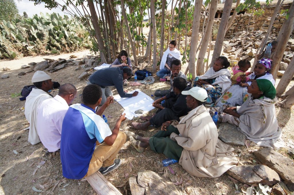
Participatory Rural Appraisal techniques are social research techniques used in the field. These techniques require trained facilitators and substantial investments to be effective. They are aimed at strengthening the analyzing and decision-making power of the affected community. They can be used in program design, implementation, monitoring and evaluation. The activities described below are usually carried out in small focus groups. In this section the main methods are described.
Mapping
Community mapping is used to collect information from the community concerning the location of resources and land uses that might not be obvious from observation alone. This may help to explain how the community views their situation and where they see opportunity and constraints. This method is more effective when used by a small group, preferably representing women and men, working to produce a large sketch map of the area in which they live. In the context of road water harvesting, some important features to be mapped are:
- Main objects and topography in the landscape such as roads, villages, churches/mosques, big trees and rocks. This will help the community and the practitioner to read the map.
- Water resources: use different symbols to represent different types, different uses and availability during the year. If necessary, describe also the water quality;
- Soil moisture: depict the areas where soil moisture is depleted faster and where the plants stay greener for longer;
- Accessibility: draw all paths that people move across
- Hotspots: places where there are special issues related to the roads and the relation with water.
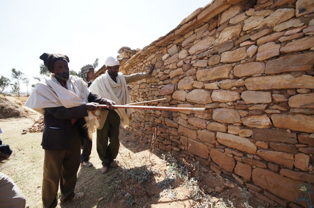
Transect walk
Transect walks are systematic walks through a selected area from one side to the opposite side. During the walk the field worker observes the landscape and the local practices and at the same time he/she interacts with the community members encountered.
A transect walk is a precious tool because it allows the community to look at their area with an innovative point of view. The participants can stop during the walk and discuss what they are seeing around them. One can even decide to stop at fixed intervals – for instance every 100 meters and then make observations. It helps in visualizing processes that need to be understood in order to plan and implement road water harvesting measures. During the exercise a sketch is drawn taking into account the changes that take place in different locations of the area investigated.
Timeline
To better understand how thing evolved, a timeline is constructed. It also helps to put the present in context and see how things may turn out.
Questions can be asked on different important aspects—like the main economic activity, means of transport, population settlements and more. To refresh the memory, important events can be used—such as what the road connection was like during the time of the last election.
The development of these timelines helps to collectively understand the past and future trends better.
Ranking
In the ranking or scoring exercise, community members are asked to list their priorities in terms of their water needs. It helps communities to prioritize solutions and challenges. It simply implies giving a score (vote) to the different discussed items and then prioritizing according to the items that got the most (or the least) votes.