Key message
- Roads have a major impact on flood plain – hydrology: they often dissect the flood plain in a wetter and drier section;
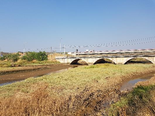
- Bridges may constrict the flood plain. whereas bridge sills may raise water and silt levels;
- Road building in flood plain requires special attention to keep flood plain conditions alive and prevent uncontrolled breaking of the roaded embankment.
Main techniques:
- Adequate drainage (with fish passage) through French mattresses and culverts will preserve the flood plain conditions
- Low embankment roads with floodways may facilitate controlled flooding into wetland areas or recharge zones
- Submerigible roads can made in flood plain that are inundated for part of the year.
Objective
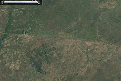
Floodplains are among the highest-potential areas for agriculture in the world, bringing together many different functions. A cautious estimate is that 50 million ha are under floodplains globally, many of them relatively pristine. Floodplains are also vulnerable to relatively minor changes in hydrology: changes in the water supply upstream or changes in the morphology of the floodplains themselves can have a drastic impact.
The development of roads in low-lying floodplains presents a special challenge and opportunity: roads in these terrains have a major effect on the area’s hydrology, both positive and negative. Roads, if built properly, will preserve and even enhance the different ecosystem services of the floodplains, but they may also undermine the floodplain, cause it to silt up, dry up, or be permanently inundated.
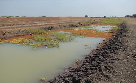
A road passing through a low-lying floodplain alters the movement of water within the floodplain and with it the wetland ecosystem and flood-based livelihoods: fishery, rangeland or flood recession, or flood-rise agriculture. This is particularly true when the road is constructed on a high, impermeable embankment. This type of road acts as a barrier that divides the floodplain into wet and dry zones. The wet zone on the upstream side will have floodwater spreading along the road embankment. In the dry zone, on the downstream side of the embankment, floodwater will be obstructed from entering. It is important to take this effect into account: it can be used to plan land use in floodplain areas. Furthermore, cross-drainage structures on these roads in particular can have a significant effect on water management. The objective of this chapter is to discuss the opportunities and recommended practices in constructing roads in floodplains.
Opportunities
The opportunities for using roads to manage floodplains differ with the type of floodplain and its predominant use. In relatively dry floodplain areas, floodwater can, for instance, be stored in the upstream zone for use in the dry season. In wetter floodplains, the road will create wetter conditions in the upstream areas, affecting the local ecology and creating conditions conducive to the cultivation of submerged crops such as rice or sugarcane. It is also important to take into account the possible effects of road construction on land submergence and silt deposition: a road or bridge in a floodplain that blocks the movement of floodwater can cause land levels to rise. Competing interests of upstream and downstream communities on either side of the road can lead to conflicts.
In developing roads in low-lying floodplains, there is a need for clarity on:
- the preferred land use and wetland functions in the floodplain area;
- the objective of the road, whether it should be passable under any circumstance; and
- the financial resources available for the road’s development.
In general, there are two key strategies while developing infrastructure in floodplains: the “resistance strategy” and the “resilience strategy” (Beever et al. 2012). The resistance strategy, in principle, aims at preventing and regulating floods, whereas the resilience strategy aims at minimizing the consequences of floods while maintaining natural floodplain dynamics as much as possible. Typically, the resistance strategy will overcome the risk of floods to the road and traffic by providing ample freeboard, which protects against all flooding. The road will be designed to withstand adverse situations without necessarily taking into account the road’s effect on the surrounding area. The resilience strategy, on the other hand, takes into account the best possible road alignment while carefully siting water crossings (at the bottom of sag curves) to minimize flood damage and ponding on the road surface. The provision of flow-through and flow-over relief structures is also part of the resilience strategy.
Recommended practices and preferred options
If the overall strategy for road development in floodplains is clear, a number of points must be settled. During road development, the following need to be decided:
- Selecting the location and height of road embankment
- Considering the use of controlled overflow sections
- Providing adequate cross-drainage and subsurface flow capacity
- Controlling the upstream water level with cross-drainage structure
- Ensuring fish passage
Alternative road option in floodplains: submergible roads
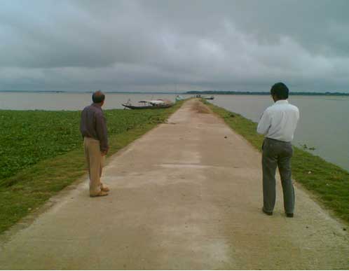
The preceding part of this chapter discussed roads on embankments in floodplains. These are all-weather or, in cases of flood, roadways are closed for a limited number of days. There is an alternative concept for roads in floodplains: roads that are submerged for large part of the year during the flooding season.
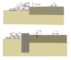
Downstream protection of a horizontal submersible track: every three to four meters an opening of an overture 10 to 15 cms wide is set to drain the road (Bender 2009). These roads are inundated during the flooding season, but facilitate transport during the dry period when they re-emerge. They can be re-used, usually after some small repairs. These submersible roads do not interfere negatively or positively with the flood regime in the floodplain.
The following requirements apply for submersible roads (Figure 11.1):
- They are based on stable bed material capable of coping with waterlogging conditions, preferably free draining and solid material: coarse sand is preferred.
- The road is slightly elevated and may be anchored at the side.
- The slope gradient is 0 percent.
- In order to avoid prolonged flooded conditions after a flood, it is possible to make one or two parts of the road 5 to 20 cms below the lower level of the ground.